
The town of Kazbegi in the Caucasus Mountains is a 3-hour marshrutka ride north of Tbilisi. Though perhaps a bit uncomfortable in a cramped marshrutka, the drive up to this mountain town was simply spectacular and the passionate traveller in me was only concerned about watching the magnificent views of Georgia while staring out the window. After spending 8 days in Tbilisi (with day trips to Mtskheta and Gori), I really felt like I was going to a special place and that I would finally get to embark on some amazing hiking in the country after hearing about such opportunities at the hostel in Tbilisi the previous week, and from fellow travellers during previous journeys. (I should also mention that this experience was a memorable chapter from my Eurotrip from two years ago in August 2013. I’ve wanted to write about this hike for awhile – better late than never, I guess!)
The picturesque Tsminda Sameba Church (Gergeti Trinity Church) overlooks the town from atop a hill, and I hiked to this point a couple hours after getting into town, taking an “off the beaten path” sort of route. I spent the late afternoon simply admiring the vibrant green fields and the majestic mountains before descending back to town to relax for the evening, knowing that the next day would be a long one.
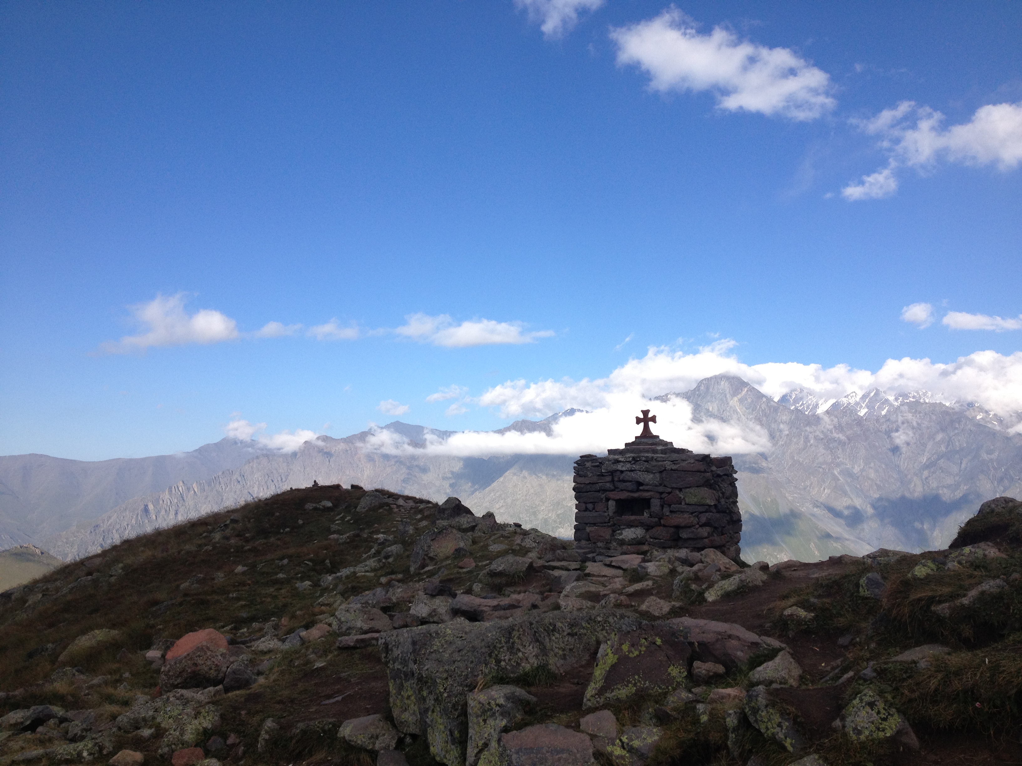
“Off the beaten path”

A shepherd tending to his herd

Confession: When I’m travelling, I can be someone who does things without much thought. I’ll get an idea and simplistically think that it will somehow just happen. My trek to Gergeti Glacier was one of those instances – I read some stories online about the logistics of the hike, went into town and bought some water and freshly made, steaming hot bread made in a tandoori-like oven, and walked and walked and walked, one foot in front of the other, in my hiking boots that took me across Spain and up one of the Alps.
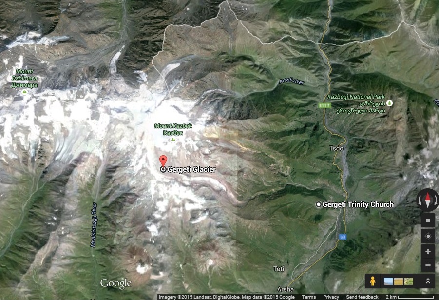
A sense of where I’d be going: from Gergeti Trinity Church to about 2 km southeast of where Gergeti Glacier is pinpointed. Also note the proximity to the Russian border. (credit to Google Maps)
Seen from the town of Kazbegi, the iconic Tsminda Sameba Church is dwarfed by Mount Kazbek.

Here’s a video after hiking about an hour from the town to the famous church:
Mount Kazbek, 5047 metres above sea level and the third highest mountain in Georgia, is one of the few mountains still snow-capped during the height of summer.

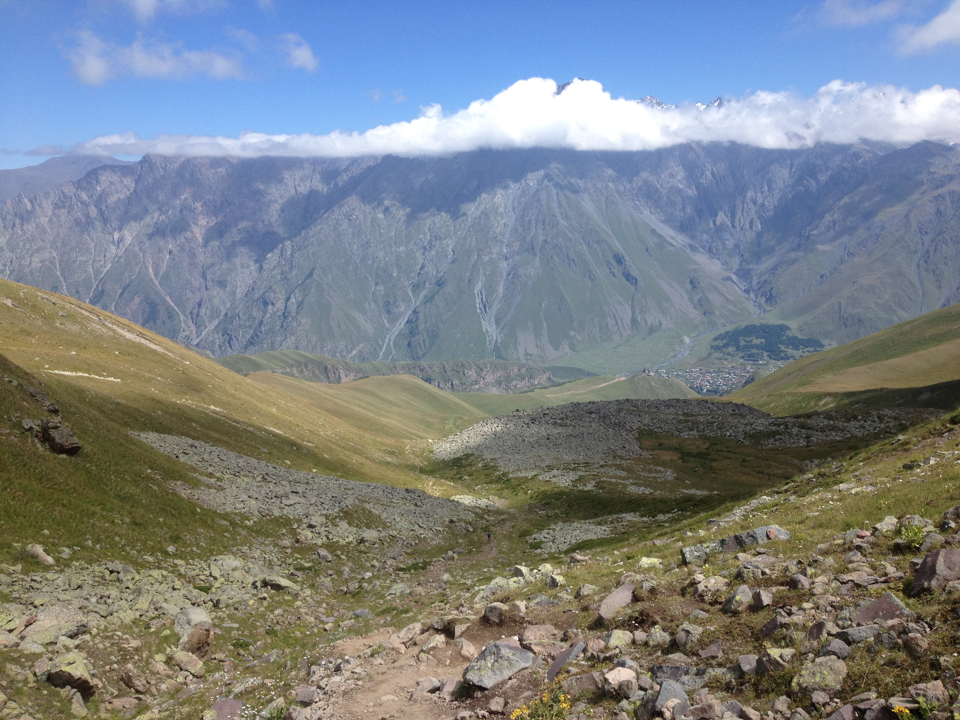
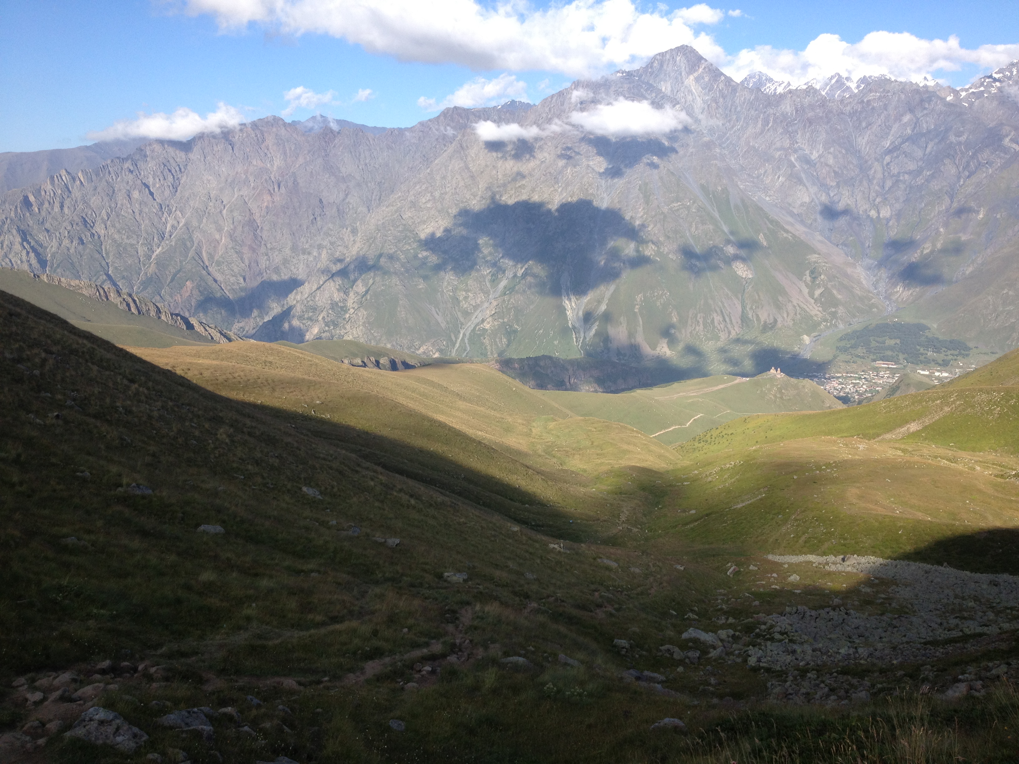
After catching my breath and admiring the beautiful church framed by the clouds and vibrant green hills, it was time to continue the hike to Gergeti Glacier. Every few minutes, I’d look back and see the church getting smaller and smaller …

…until it was just a speck in the breathtaking landscape. You have to look really hard to see it in this picture!
This was a really strenuous trek for me, the most challenging exercise I’d gotten since I climbed the Untersberg in Austria the month before. I began the hike later than I had intended so really pushed myself to keep going in order to make it back before dark, but I had to take a break at this spot …

…and have my picture taken 😉

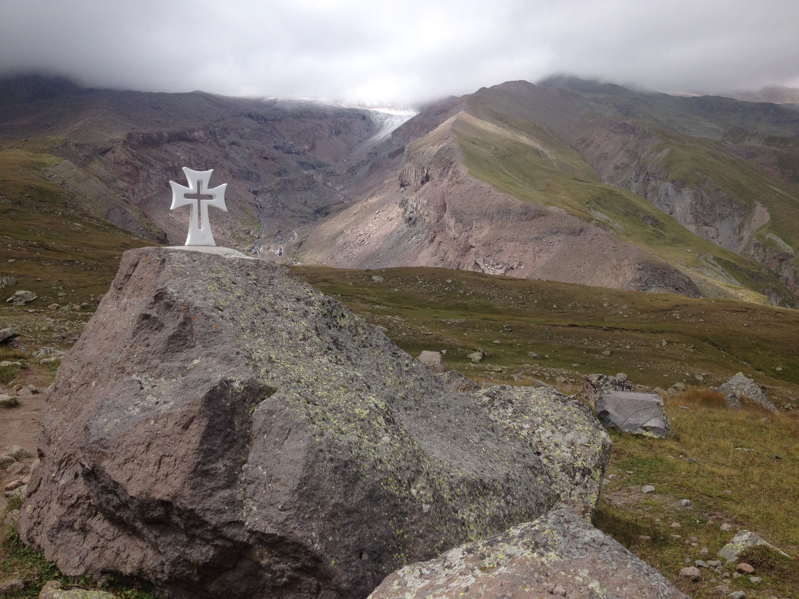
I met a group of Turkish hikers descending, impressing them with a few Turkish phrases I had learned the year before when I travelled through Turkey. Visibility also became much poorer from this altitude, but I could see the tongue of the Gergeti Glacier for the first time.

And here’s a closer look:
Then there was a stream I was walking along that gradually became stronger as I walked upstream. Perhaps it wouldn’t be correct to call it a river, but it was a rushing body of water that presented a challenge since I needed to cross it somehow…

Here’s an idea of what I was up against. Perhaps you can sense my frustration and anxiety…
I didn’t want to backtrack so kept hiking up, struggling to find a suitable pass. Eventually I saw a group of 4 Spaniards/Italians on the other side, and was surprised to see them take off their boots and socks, roll up their pants, and walk barefoot across the river. And with that example, I decided to do the same. Thankfully, the water wasn’t too deep but it was practically ice cold (its source was a melting glacier, after all). One of the guys lent me his hiking pole to help give me balance and after I crossed, they applauded me and I threw back the pole, grateful for the assistance and encouragement.
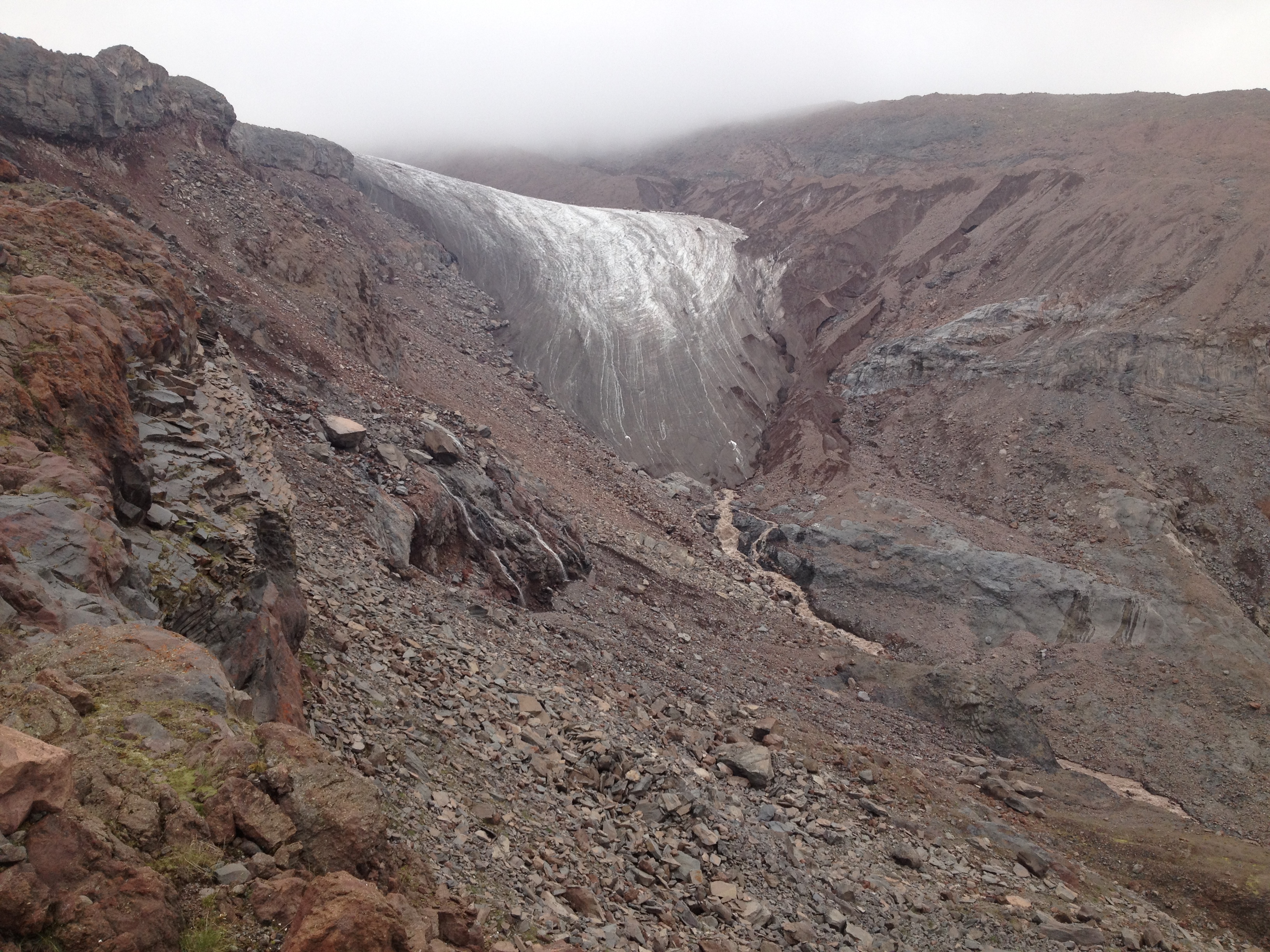
I continued up, passing a campsite on the way, getting closer to the glacier with each step forward. A closer look at the tongue of the glacier:
I met 3 Englishmen coming down and asked them how much longer to the glacier. They debated amongst themselves, but I think they eventually suggested it would take another half an hour. And so, a bit over five hours since beginning the hike from town, I made it to the glacier, surprised at how dark it was from all the sediment…

This was as far as I’d go. But it was great to acknowledge that I made it. The guidebook says that Kazbegi is 1750m above sea level, Tsminda Sameba is 2200m above sea level, and Gergeti Glacier is 900m higher. So if that was the case, I ascended ~1350m to get to this point, astonished to be standing on such a massive sheet of ice, on a mountain in Georgia close to the Russian border, with no one else in sight at this particular moment. It felt like I was in another world…
After taking it all in, it was time to make the trek back. With great misfortune, I dropped my camera while taking pictures with gloved hands and reduced grip. The LCD screen shattered, though I later learned that the camera could still take photos. Anyway, visibility improved on the way down…
I was amazed back then as I am amazed now 2 years later as I type these words, knowing that I was surrounded by so much natural beauty that day…
I arrived back in town shortly before 8pm, after just about 9 long but gratifying hours of hiking. It was time to indulge in a well-earned, delicious homemade dinner at my guesthouse!
In retrospect, it was nice to walk in a tranquil setting in relative isolation, while at the same time comforted by the fact that there were enough fellow hikers to know that I wasn’t really alone should something have gone awry. The trails were beautiful, relatively straight-forward to navigate and nothing over-trodden. There were no markers and I just had a few screenshots on my phone as a reference, but I managed just fine in the end and managed to get there (and back – that’s always important, too!) To this date, this has been one of my favourite and most memorable hikes.
